
Silicon Valley’s relentless pace demands an antidote. These 15 trails transform tech workers into weekend warriors, offering everything from 30-minute nature breaks to summit challenges that rival any product launch.
- Why San Jose’s Trail Network Is Your Ultimate Stress-Relief System
- Aquila Loop Trail panoramic sunset views
- Los Gatos Creek Trail family adventures
- Coyote Peak Loop moderate workout
- Mission Peak from Ohlone College
- Waterfall Loop magical Uvas Canyon
- Mount Umunhum Trail historic summit
- Wildcat Loop Rancho San Antonio classic
- South Rim Loop Alum Rock adventure
- Mockingbird Loop historic Almaden Quicksilver
- Seven Springs Loop Fremont Older escape
- Lisa Killough Loop Calero grasslands
- Penitencia Creek Trail urban oasis
- Guadalupe River Trail downtown nature
- Monument Peak hidden alternative
- Castle Rock Loop adventure summit
- Frequently Asked Questions About Hiking Trails Around San Jose
- What’s the best time of year to hike around San Jose?
- Do I need special gear for South Bay hiking trails?
- How do I avoid parking nightmares at popular trails?
- Which trails are actually good for hiking beginners?
- Where can I hike with my dog near San Jose?
- From Desk to Trail: Your Silicon Valley Escape Plan
Why San Jose’s Trail Network Is Your Ultimate Stress-Relief System
Living in the innovation capital means constant screen time and deadline pressure. But within 45 minutes of downtown San Jose, over 300 miles of trails wait to reset your mind. From wheelchair-accessible lakeside paths to knee-burning summit climbs, the South Bay offers year-round hiking that fits any schedule or fitness level.
The key to sustainable hiking here? Understanding parking realities, avoiding weekend crowds, and choosing trails that match your current fitness—not your ambitions. This guide provides the insider intelligence that transforms frustrating attempts into successful adventures. Every trail includes honest difficulty ratings calibrated for desk workers, not ultramarathoners.
Quick Summary
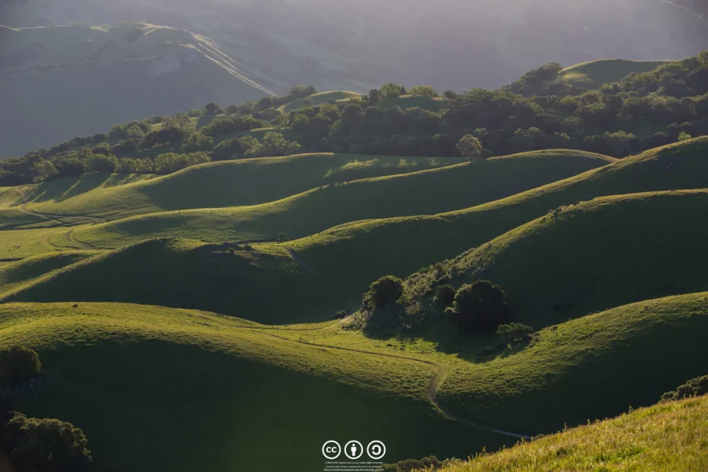
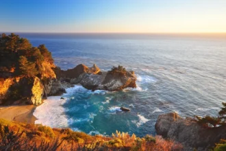
Aquila Loop Trail panoramic sunset views
For minimal effort and maximum payoff, nothing beats Aquila Loop. This 1.1-mile circuit delivers what usually requires hours of climbing—360-degree views from San Francisco to Loma Prieta. The catch? Only 37 parking spots, and sunset seekers know to arrive 90 minutes early on weekends.
Smart hikers tackle this fully exposed trail at 7am or after 5pm to avoid the scorching sun. Spring transforms the brown hills into Instagram gold with poppies and lupine. Pro tip: walk counter-clockwise as required, and that bench halfway around faces west—perfect for sunset meditation.
Insider Intel for Aquila Loop
Details for Aquila Loop
Los Gatos Creek Trail family adventures
This paved paradise through Vasona Lake Park serves as Silicon Valley’s backyard playground. The 2.5-mile loop stays blissfully flat, making it perfect for stroller-pushing parents, beginning joggers, and anyone nursing that CrossFit injury. Massive oaks shade 70% of the route—crucial for summer survival.
Weekends transform the trail into a community parade, but arrive before 10am to snag parking without circling. The connected Oak Meadow Park features a vintage carousel and miniature railroad that runs weekends—bribery tools for reluctant kid hikers. Downtown Los Gatos sits five minutes away for post-walk brunch.
Local Secrets for Los Gatos Creek
Details for Los Gatos Creek Trail
Coyote Peak Loop moderate workout
Santa Teresa’s Coyote Peak delivers the 360-degree summit experience tech workers crave without the soul-crushing crowds of Mission Peak. The 3.8-mile loop climbs 750 feet through oak-studded grasslands, offering Mount Hamilton views to the east and ocean glimpses west on clear days.
March through May transforms these hills into California’s postcard—green slopes dotted with orange poppies and purple lupine. The massive 170-car lot rarely fills completely, but smart hikers still start early to beat the heat on this 90% exposed trail. Pack 2 liters of water minimum.
Pro Tips for Coyote Peak
Details for Coyote Peak

Mission Peak from Ohlone College
Mission Peak stands as Silicon Valley’s Everest—a brutal 2,100-foot climb that separates casual walkers from serious hikers. The Ohlone College route adds distance but solves the Stanford Avenue parking nightmare with 900 reliable spaces. This strategic choice alone transforms a frustrating experience into a manageable challenge.
The 6.8-mile round trip punishes unprepared legs with relentless switchbacks on shadeless fire roads. Summer temperatures can hit 100°F on the exposed slopes—carry 3 liters minimum. But reaching that famous summit pole, seeing the entire Bay Area spread below, creates an addictive high that keeps people coming back.
Weekends bring continuous crowds marching up the mountain. For solitude, start at sunrise or tackle it on a Tuesday. The college parking costs $4 weekdays but goes free Sundays. Pro move: headlamp for sunset descent avoids both heat and humanity.
Survival Guide for Mission Peak
Details for Mission Peak
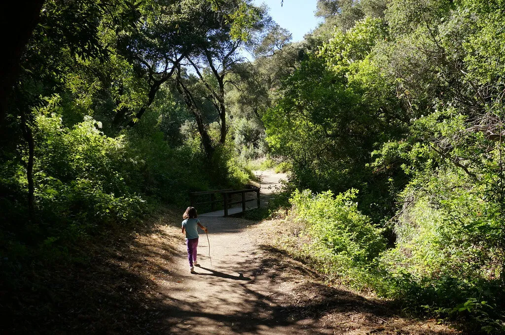
Waterfall Loop magical Uvas Canyon
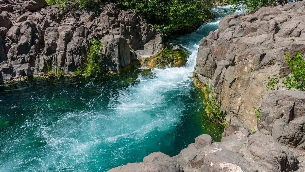
Uvas Canyon performs magic from February through May, transforming a quiet forest into the South Bay’s waterfall wonderland. The mandatory reservation system ($6, book weeks ahead) keeps crowds manageable while protecting this fragile ecosystem. Seven named falls cascade along a one-mile loop through redwood and bay forest.
Basin Falls and Black Rock Falls steal the show, especially after heavy storms when water thunders over moss-covered rocks. The trail stays 90% shaded under towering trees, making it comfortable even on warm days. No cell service means downloading your reservation beforehand—screenshot everything.
Waterfall Wisdom for Uvas
Details for Waterfall Loop
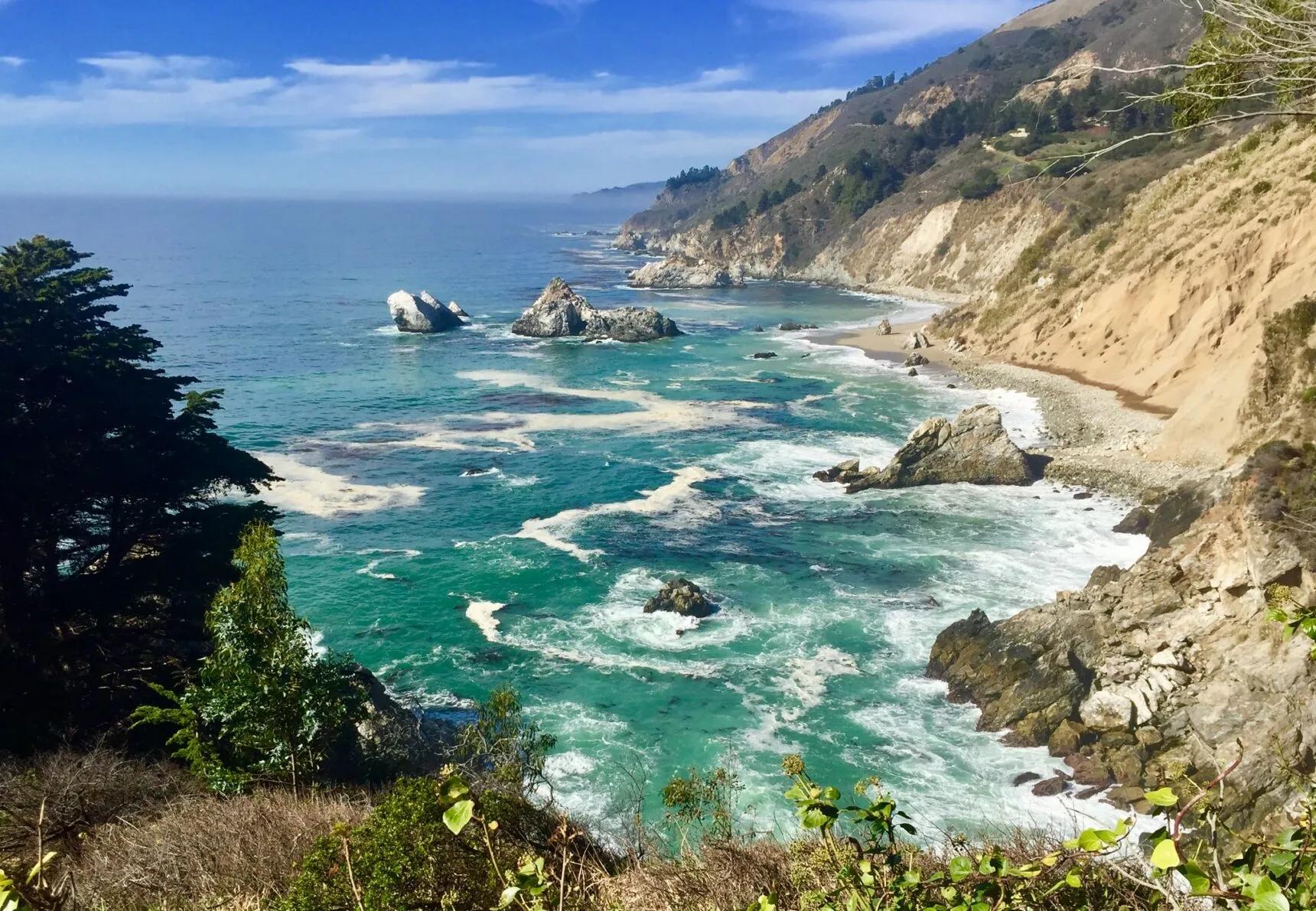
Different neighborhood? We’ve covered beaches within driving distance of San Jose for when you need ocean views instead of mountain peaks.

Mount Umunhum Trail historic summit
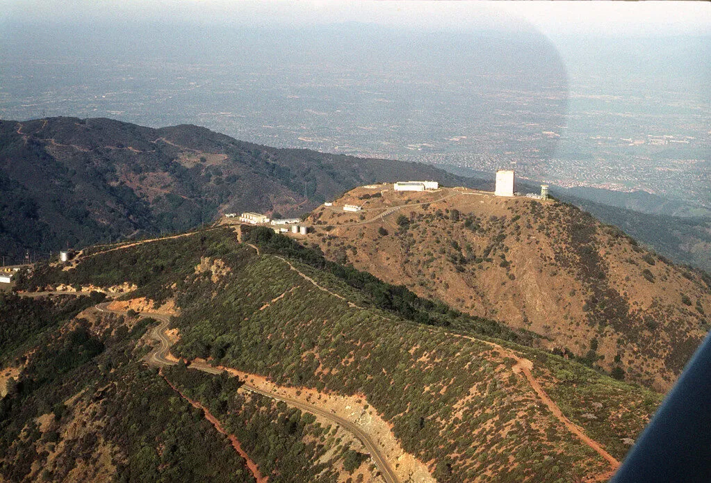
Mount Umunhum offers Silicon Valley’s most meaningful summit experience. At 3,486 feet, this sacred Ohlone site topped by a massive concrete radar cube delivers 360-degree views from the Sierra Nevada to Monterey Bay. The 7.8-mile round trip climbs steadily through oak woodlands and chaparral on a beautifully engineered trail.
Only 23 parking spots at Bald Mountain trailhead fill by 9am weekends—arrive at sunrise or hike weekdays. The summit’s ceremonial circle honors the Amah Mutsun people, while interpretive displays explain both indigenous history and Cold War operations. Pack layers: the peak runs 20 degrees cooler than the valley.
Clever groups drop hikers at Bald Mountain while drivers continue to the summit lot (54 spaces), then everyone meets at the top. Water and restrooms bookend the trail, but the middle miles offer no services. Spring wildflowers and fall colors make ideal seasons.
Mount Umunhum Insider Info
Details for Mount Umunhum
Wildcat Loop Rancho San Antonio classic
Rancho San Antonio earns its “weekend zoo” reputation honestly—300 parking spots fill by 8am Saturdays. But the crowds come for good reason: Wildcat Loop packs shaded canyons, open meadows, ridge views, and a working farm into 5 manageable miles. The electronic parking sign at the entrance shows real-time availability.
Start with the flat mile to Deer Hollow Farm, where heritage breeds graze and kids can explore historic barns. Then Wildcat Canyon’s fern-lined creek leads to a heart-pumping climb up exposed switchbacks. The ridge rewards with Mount Hamilton views before descending through fragrant bay laurel groves.
Beat the Crowds at Rancho
Details for Wildcat Loop
South Rim Loop Alum Rock adventure
Alum Rock Park hides a secret: park outside the main entrance in the free 20-car lot and save $6. This California’s oldest municipal park delivers drama with its canyon-to-rim elevation change. Start along Penitencia Creek’s shaded floor, passing mineral springs and stone bridges from the 1890s spa era.
Then reality hits—tight switchbacks rocket you 770 feet up to the South Rim. The exposed ridge trail scorches in summer but rewards with sweeping valley views. Weekends bring families to the creek and fitness fanatics to the rim. Note: several trails remain closed from 2023 storms—check current maps.
Alum Rock Survival Tips
Details for South Rim Loop
Mockingbird Loop historic Almaden Quicksilver
Almaden Quicksilver’s 4,000 acres hide California’s mining past in plain sight. This free park’s Mockingbird Loop climbs 600 feet through landscapes shaped by 135 years of mercury extraction. The wide fire roads pass mine entrances (safely sealed) while interpretive signs explain how this toxic element helped extract California’s gold.
The 3.9-mile loop offers Guadalupe Reservoir views and spring wildflowers without the crowds plaguing smaller preserves. Cell service disappears quickly—download maps beforehand. The small lot fills weekend mornings, but nothing like Mission Peak madness. Dogs love this trail, and equestrians share the wide paths peacefully.
Quicksilver Quick Tips
Details for Mockingbird Loop
Seven Springs Loop Fremont Older escape
Fremont Older delivers what busy professionals need: quick nature access without the commute. The Seven Springs Trail section offers rare single-track through shaded oak groves—a refreshing change from wide fire roads. Combined with ridge trails, this 3-mile loop packs variety into 90 minutes, perfect for that 5pm escape.
The tiny Prospect Road lot (20 cars max) creates natural crowd control. Street parking adds a quarter-mile walk but guarantees access. Mountain bikers love these trails, so stay alert on blind corners. Maisie’s Peak detour adds 15 minutes but delivers 360-degree views worth the climb.
Fremont Older Hacks
Details for Seven Springs
Lisa Killough Loop Calero grasslands
Calero’s Lisa Killough Loop rewards endurance hikers with 8.3 miles of open grassland beauty. This isn’t a quick workout—budget 4 hours for the full experience. The payoff comes at Lisa’s Lookout picnic area, where Calero Reservoir sparkles below while Mount Umunhum towers above. Spring wildflower displays rival any in the Bay Area.
Zero shade means starting by 8am in warmer months. The wide fire roads handle mountain bikers and equestrians easily, preventing trail conflicts despite the park’s popularity. Rancho San Vicente entrance parking stays free (unlike main Calero entrance), and the large gravel lot rarely fills completely. Bring 3 liters of water—you’ll need it.
Calero Survival Guide
Details for Lisa Killough
Penitencia Creek Trail urban oasis
This East San Jose gem serves locals who know better than fighting weekend crowds at famous trails. The paved path follows Penitencia Creek for 2.8 miles through a shaded corridor of sycamores and oaks. Best part? It connects directly to Alum Rock Park’s extensive trail system, letting ambitious hikers extend into mountain terrain.
Families rule weekend mornings at Penitencia Creek Park’s playground while commuter cyclists zip past heading downtown. The trail’s multiple access points mean easy bail-outs for beginners. Post-hike, East San Jose’s authentic Vietnamese and Mexican restaurants along Story Road offer the best pho and tacos in Silicon Valley—no trendy markup.
Local Secrets for Penitencia
Details for Penitencia Creek
Guadalupe River Trail downtown nature
San Jose’s main artery trail proves nature thrives even downtown. This paved path runs 11 miles from Almaden Lake to Alviso Marina, but most tackle manageable chunks. The Arena Green section near SAP Center combines river views, public art installations, and the Heritage Rose Garden’s 3,500 bushes blooming April through November.
No dedicated trail parking means using downtown garages, but excellent public transit access compensates—light rail and buses stop blocks away. Winter flooding occasionally closes underpasses, but the city posts detours. Early mornings offer peaceful commuter-free experiences. The trail passes directly by San Pedro Square Market for craft beer rewards.
Downtown Trail Tips
Details for Guadalupe River
Monument Peak hidden alternative
Ed Levin Park’s Monument Peak delivers everything Mission Peak promises but with 90% fewer selfie-seekers. The 7.8-mile round trip climbs 2,000 feet to nearly identical views—same Bay Area panorama, same leg-burning workout, but actual solitude at the summit. The trail feels wilder, passing through oak woodlands before opening to windswept ridges.
Sandy Wool Lake entrance offers reliable parking even on weekends. The climb starts gently before turning serious on the Monument Peak Trail’s exposed switchbacks. No summit pole here—just a simple benchmark and 360-degree views earned without waiting in line. Dogs welcome on-leash makes this the choice for four-legged hiking partners.
Monument Peak Advantages
Details for Monument Peak
Castle Rock Loop adventure summit
Castle Rock delivers the Santa Cruz Mountains’ most dramatic scenery just 45 minutes from San Jose. The 5.5-mile loop showcases everything: ancient sandstone formations sculpted by wind into Swiss cheese patterns, Douglas fir forests draped in moss, and clifftop views stretching to Monterey Bay. Rock climbers tackle the tafoni while hikers explore easier routes.
The $10 state park fee feels worth it immediately. Zero cell service enforces digital detox—download maps beforehand. The Saratoga Gap Trail winds through primeval forest before reaching Castle Rock’s overlook, where climbers spider up vertical walls. Continue the loop through varying ecosystems, each turn revealing new geology. Weekday visits guarantee parking in the 90-car lot.
Summer fog often shrouds the mountains while valleys bake—bring layers. The trail surface varies from smooth dirt to rocky scrambles requiring attention. This isn’t a mindless fitness loop but an adventure requiring presence. Post-hike, Highway 9 descends through redwoods to Saratoga’s wineries.
Castle Rock Insider Knowledge
Details for Castle Rock
Frequently Asked Questions About Hiking Trails Around San Jose
What’s the best time of year to hike around San Jose?
Spring (March-May) offers the triple crown: green hills, wildflowers, and flowing waterfalls. Fall brings stable weather and clear views. Summer requires early starts before 8am to beat dangerous heat on exposed trails. Winter means muddy conditions but empty trails.
Do I need special gear for South Bay hiking trails?
Basics suffice for most trails: sturdy shoes, 2+ liters of water, sunscreen, and a hat. Mission Peak and Mount Umunhum demand 3 liters minimum. Trekking poles help on steep descents. Download offline maps since cell service disappears quickly in the hills.
How do I avoid parking nightmares at popular trails?
Arrive before 8am on weekends or hike weekdays. Use Ohlone College for Mission Peak (900 spaces vs Stanford’s 40). Check openspace.org/rsa-parking for Rancho San Antonio’s live status. Consider lesser-known alternatives like Monument Peak when Mission Peak lots overflow.
Which trails are actually good for hiking beginners?
Los Gatos Creek Trail and Guadalupe River Trail offer paved, flat paths perfect for building fitness. Aquila Loop delivers big views for just 1.1 miles. Penitencia Creek Trail provides shade and creek sounds. Save Mission Peak for after you’ve conquered easier summits.
Where can I hike with my dog near San Jose?
Most trails allow leashed dogs except Alum Rock Park (wildlife sanctuary) and Rancho San Antonio (past the farm). Fremont Older, Almaden Quicksilver, and Monument Peak welcome four-legged hikers. Always bring extra water—dogs need hydration too on these exposed trails.
From Desk to Trail: Your Silicon Valley Escape Plan
These 15 trails transform South Bay living from all-screen to full-scene. Whether you need a 30-minute nature reset or a summit challenge to humble your ego, San Jose’s surrounding hills deliver. Start with easier trails like Los Gatos Creek to build fitness, then progress to moderate loops like Coyote Peak. Save Mission Peak and Mount Umunhum for when you’re ready to earn those summit selfies.
Remember: parking strategy matters as much as hiking fitness here. Those pre-8am weekend starts unlock empty trails and guaranteed spaces. Download offline maps, pack more water than you think you need, and respect the summer sun’s brutal power on exposed slopes. Your desk job body will thank you for starting gradually—these trails aren’t going anywhere.
Save this guide for weekend planning and share with coworkers ready to trade conference rooms for trail summits. Looking for more Bay Area adventures? Check out our guide to weekend getaways from San Jose.

