After the 2024 repairs, Big Sur’s viewpoints finally reopened — but now tour buses descend like locusts between 10am-3pm, turning peaceful stops into selfie battlegrounds.
- Smart Timing for Big Sur’s Most Scenic Highway 1 Stops
- Bixby Creek Bridge Vista Point
- Point Sur Lighthouse Vista
- Andrew Molera State Park Beach Trail
- Pfeiffer Beach Overlook (Sycamore Canyon Road)
- Nepenthe Restaurant Viewpoint
- McWay Falls Overlook Strategy
- Partington Cove Trail Hidden Parking
- Sand Dollar Beach Vista Point
- Willow Creek Vista Point (Mile Marker 21)
- Jade Cove Access Point
- Ragged Point Inn Last Stop Paradise
- Elephant Seal Vista Point
- FAQ About Big Sur Highway 1 Viewpoints
- When do tour buses run on Highway 1 and how can I avoid them?
- Which viewpoints have actual flush toilets vs vault toilets vs nothing?
- Is there really nowhere to park for free along Big Sur?
- What’s the cell phone coverage situation along Highway 1?
- How much time should I budget for driving Highway 1 with photo stops?
- Are there alternatives when Highway 1 closes for repairs or weather?
- Final Thoughts: Timing Your Big Sur Journey
Smart Timing for Big Sur’s Most Scenic Highway 1 Stops
The secret to enjoying Big Sur isn’t finding hidden spots — it’s knowing when tour buses can’t navigate certain pullouts and which viewpoints have actual facilities. After driving this route monthly for work, I’ve mapped every reliable restroom and parking situation between Carmel and San Simeon.
New 2025 reality: CalTrans added “No Bus Parking” signs at six viewpoints, instantly improving the experience. Plus, three locations now have upgraded restroom facilities thanks to increased visitor fees. Here’s your comfort-focused guide to Highway 1’s best views — no bush-squatting required.
Quick Summary
Planning a longer trip? Check out our complete California road trip itineraries — we’ve mapped every scenic route with practical timing.
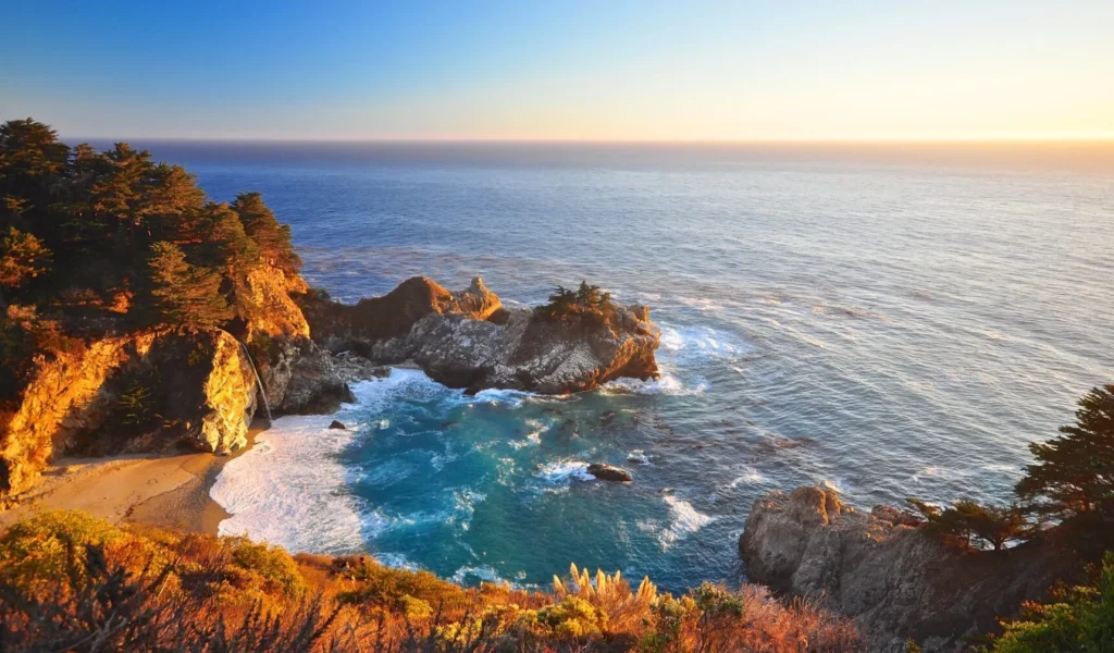
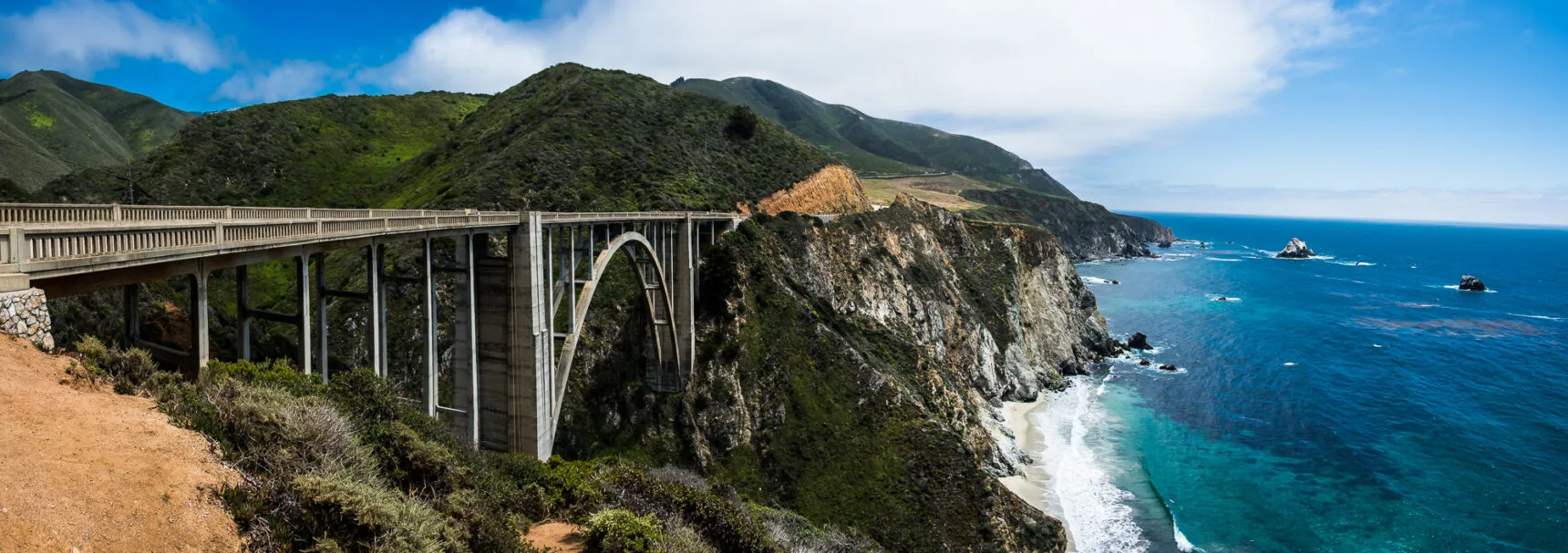
Bixby Creek Bridge Vista Point

The most photographed bridge on Highway 1 got major upgrades in late 2024. New vault toilets hide behind the info kiosk (follow the subtle blue signs), and they expanded parking to 45 diagonal spaces. Tour buses arrive at 10:30am sharp and clog everything until 2pm — come before 9am or after 4pm for breathing room.
Pro move: skip the main pullout entirely. Drive 0.3 miles north to the unmarked dirt turnout near mile marker 64.2 — same view, zero crowds, space for 6 cars. Locals use this spot for sunset photos when the main lot turns into a tour bus convention. Just watch for cyclists when pulling back onto Highway 1.
What Makes Bixby Bridge Special
Details for Bixby Creek Bridge
Point Sur Lighthouse Vista
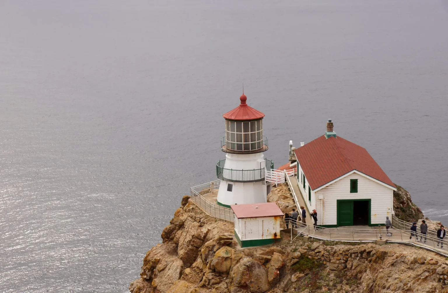
This former naval facility retained its military-grade facilities — meaning actual flush toilets, not just porta-potties. The massive parking lot (100+ spaces) never fills because most tourists skip it for flashier viewpoints. Tour buses rarely stop here since the lighthouse tours require advance booking and take 3 hours.
Wednesday mornings at 10am, docents lead free 20-minute talks about gray whale migration from the lower parking area — no tour booking needed. The gift shop attendant makes fresh coffee ($2 donation) and knows which turnouts have condors circling. Worth the slight detour off Highway 1 just for the cleanest restrooms between Carmel and Cambria.
What Makes Point Sur Special
Details for Point Sur Lighthouse
Andrew Molera State Park Beach Trail
The $10 day-use fee acts like tour bus repellent at Andrew Molera. While everyone fights for free pullouts, this park offers clean vault toilets, 80 parking spaces, and a stunning 1-mile beach trail. Rangers installed new facilities in March 2025, including a rinse station for sandy feet and a covered picnic area perfect for lunch.
Skip the main beach trail on weekends — instead take the Ridge Trail (0.3 miles past entrance) for the same coastal views minus the crowds. The secret sunset spot sits at Creamery Meadow overlook, where you’ll share the view with maybe two other cars. Parking pass works at all Big Sur state parks the same day, maximizing your $10 investment.
What Makes Andrew Molera Special
Details for Andrew Molera State Park

Pfeiffer Beach Overlook (Sycamore Canyon Road)
Forget fighting crowds at Pfeiffer Beach parking lot. This unmarked pullout on Sycamore Canyon Road delivers better views without the $12 fee or weekend warfare. The sharp hairpin turn from Highway 1 physically prevents buses and RVs from accessing this spot. Room for 8 cars on the widened shoulder, though locals know only the first 4 spots have ocean views.
No facilities here, but that’s the price of solitude. Time it for 5:30pm when golden hour light hits the offshore rocks — same angle as McWay Falls but zero selfie sticks. The resident red-tailed hawk circles daily at 6pm, hunting in the canyon thermals. Just remember: no overnight parking (sheriff checks at 11pm).
What Makes This Overlook Special
Details for Pfeiffer Beach Overlook
Staying overnight? Our guide to Carmel’s boutique hotels includes properties with early checkout for Big Sur day trips.
Nepenthe Restaurant Viewpoint
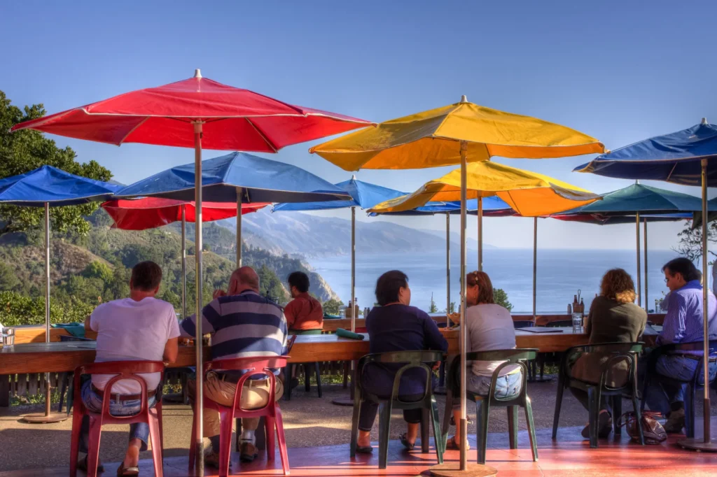
Nepenthe solves every Big Sur comfort issue: clean restrooms, ample parking (120 spaces), and a view that rivals McWay Falls. Skip the $22 burger — instead grab a $6 coffee at the outdoor Café Kevah and camp on the terrace all afternoon. The parking lot attendant won’t hassle coffee customers, even during peak summer lunch rush.
Restrooms downstairs stay cleaner than the main restaurant’s. The Phoenix gift shop (separate entrance) has the only reliable cell signal for miles — Verizon customers can even hotspot from the book section. January-March, gray whales pass so close you’ll see spouts from your terrace table. Just bring layers — the afternoon wind could frost a margarita.
What Makes Nepenthe Special
Details for Nepenthe

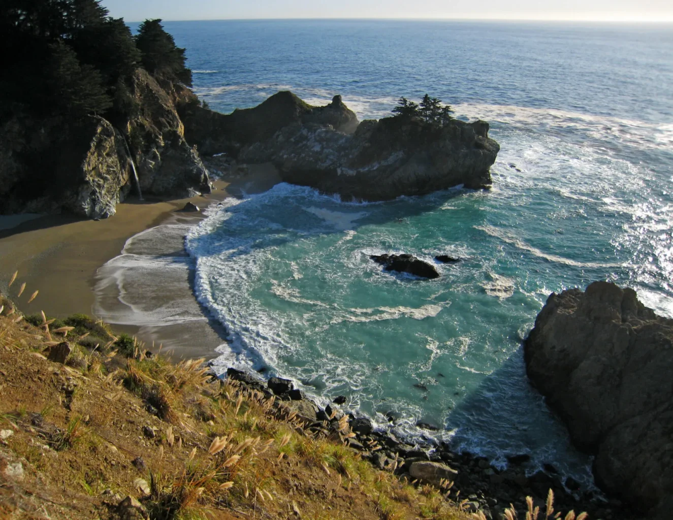
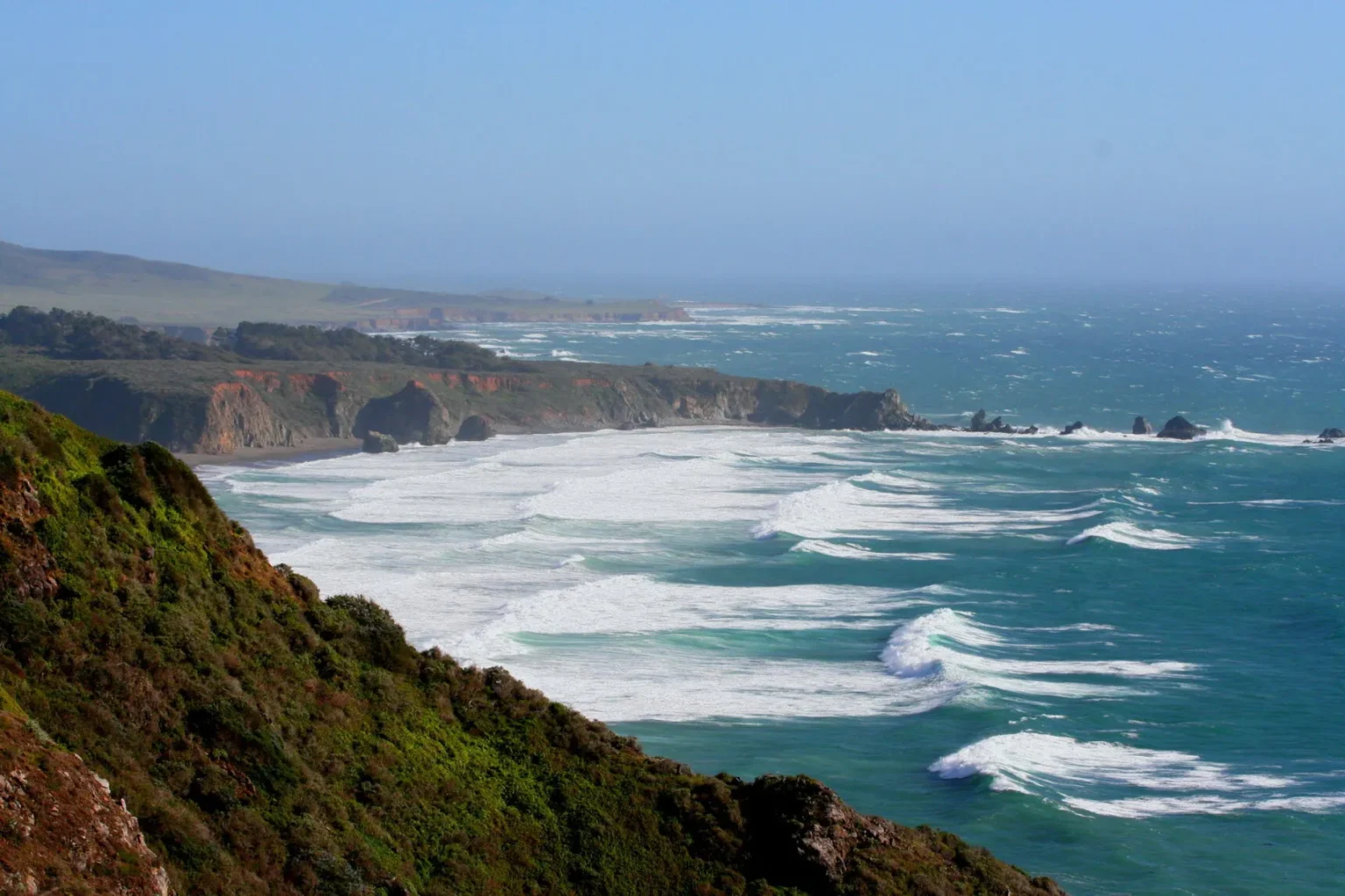
McWay Falls Overlook Strategy
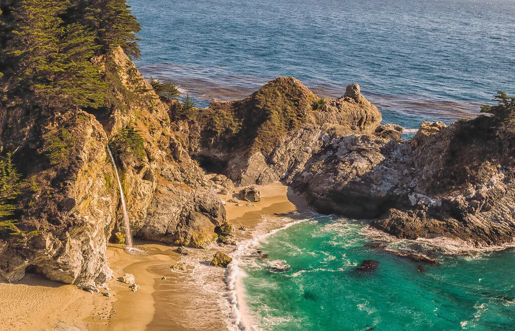
Yes, McWay Falls attracts mobs, but only because people arrive at the wrong time. The viewing platform holds 30 people comfortably — at 2pm, there’s 200 fighting for selfies. Come at 7am (parking lot opens at sunrise) and you’ll share the 80-foot waterfall with maybe five early birds. The new vault toilets near the parking area beat the old porta-potties.
Skip the main viewpoint entirely on weekends. Instead, walk north on the Overlook Trail for 0.2 miles to the unmarked secondary viewpoint — same waterfall, different angle, fraction of the crowds. The trail continues to Partington Cove (2 miles total), but most tourists turn back after their waterfall photo, leaving the rest peaceful.
What Makes McWay Falls Special
Details for McWay Falls
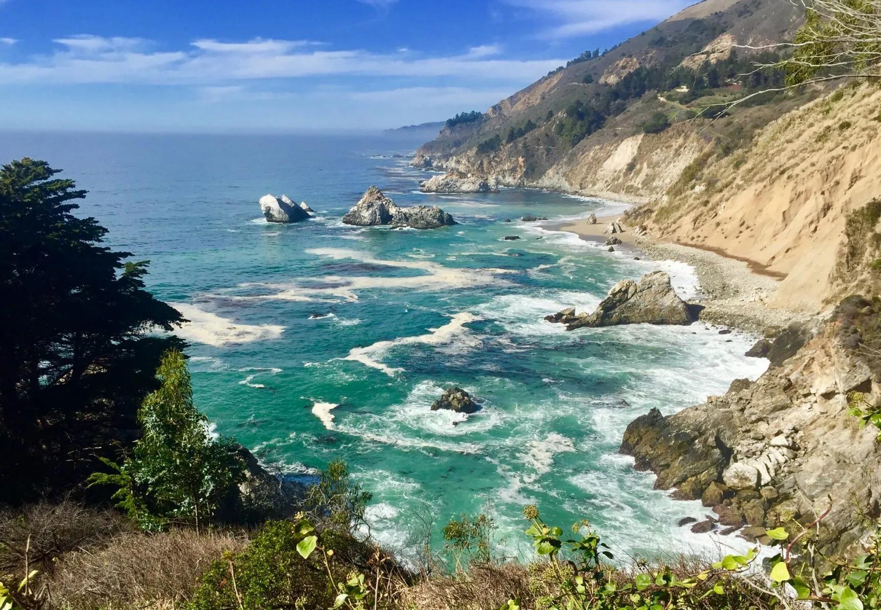
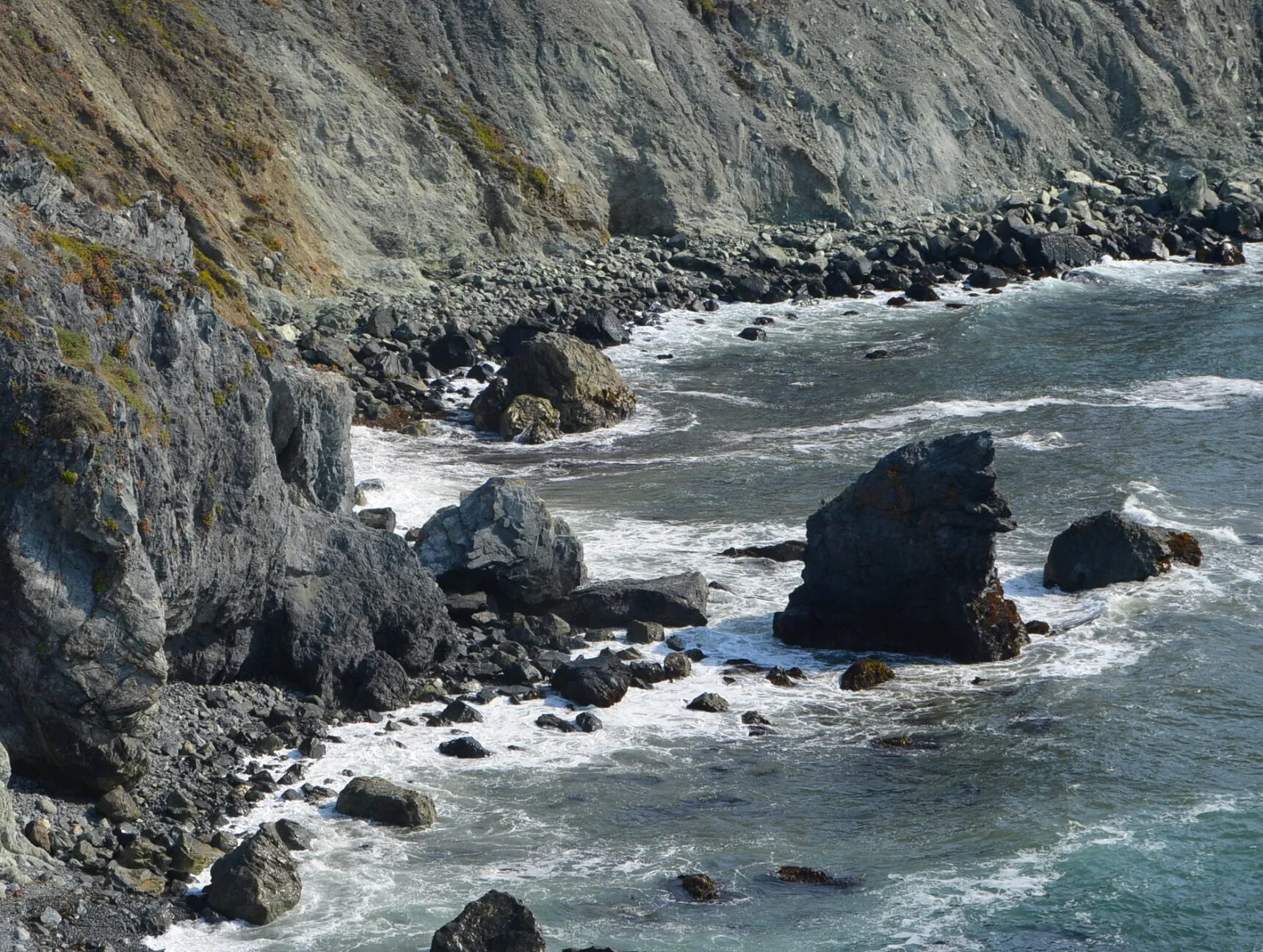
Partington Cove Trail Hidden Parking
The unmarked metal gate at mile marker 33.5 looks private property, which keeps 90% of tourists away from this gem. Park along the wide shoulder (room for 12 cars) and slip through the pedestrian opening. The 0.5-mile trail drops through redwood forest to a hidden cove where smugglers once loaded barrels of tanbark. No facilities, but that’s why it stays empty.
Low tide reveals tide pools that marine biology classes from UCSC visit monthly — look for ochre sea stars recovering from the 2013 wasting disease. The wooden footbridge over Partington Creek makes for moody photos in morning fog. Locals know to bring headlamps for the tunnel section rather than using phone flashlights that die halfway through.
What Makes Partington Cove Special
Details for Partington Cove
Sand Dollar Beach Vista Point
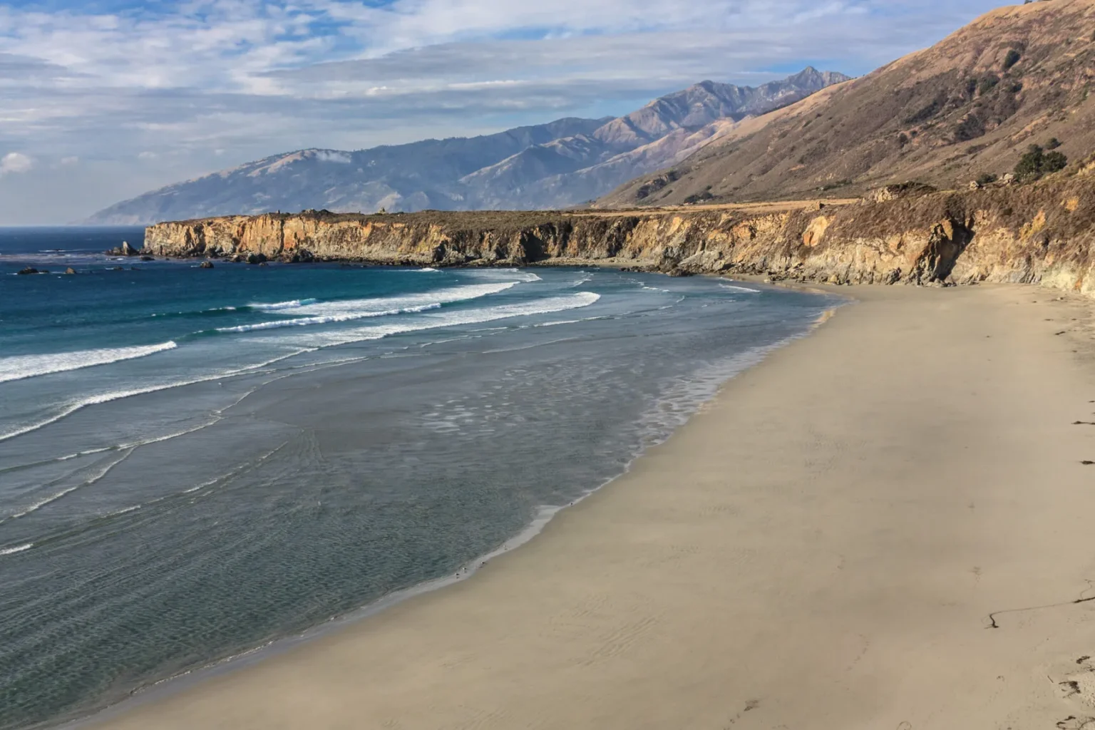
While everyone battles for parking up north, Sand Dollar Beach sits half-empty with 70 spots and clean restrooms maintained by Los Padres National Forest. The massive parking lot rarely fills, even on holiday weekends. The $10 day-use fee includes access to Plaskett Creek Campground’s facilities — real flush toilets and hot water sinks, luxury by Big Sur standards.
Surfers hit the beach at dawn, leaving by 10am when the wind picks up. That’s your cue to arrive — claim their vacant spots and enjoy the protected cove without wetsuit-clad crowds. The hang gliders launch from the bluff at 2pm on windy days, providing free entertainment. Jade hunters work the south end at low tide, occasionally finding California’s state gem.
What Makes Sand Dollar Beach Special
Details for Sand Dollar Beach
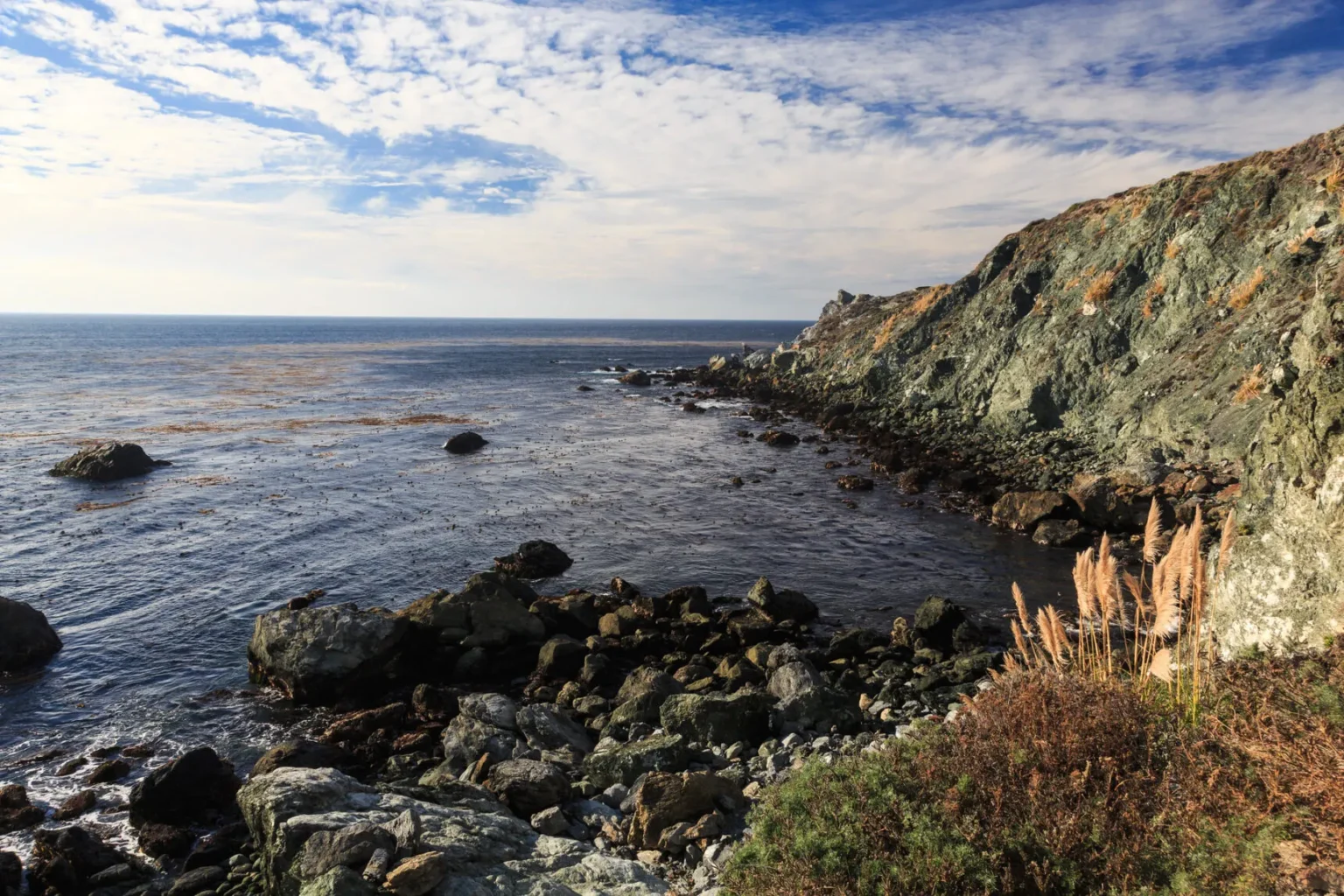
Willow Creek Vista Point (Mile Marker 21)
This wide pullout at mile marker 21 stays empty because GPS doesn’t list it and no signs mark it. Room for 15 cars on the paved shoulder, with chest-high stone walls perfect for laptop work (AT&T gets 3 bars here). Local real estate agents conduct video calls from this spot, knowing it’s the only reliable signal between Sand Dollar Beach and Ragged Point.
March through May, the hillside explodes with California poppies and lupine — better display than the crowded Garrapata spots. No facilities, but Willow Creek Picnic Area sits 0.5 miles south with vault toilets. The resident seal colony on the rocks below performs best at 4pm feeding time. Just remember: poison oak grows thick beyond the stone wall.
What Makes Willow Creek Vista Special
Details for Willow Creek Vista
Jade Cove Access Point
The steep trail to Jade Cove scares off most visitors, leaving this treasure-hunting spot to serious rockhounds. Park in the dirt pullout near mile marker 13 (room for 10 cars) and look for the narrow trail marked only by a small cairn. The sketchy descent requires using fixed ropes — definitely not for kids or anyone unsure on their feet. No facilities up top.
Low tide reveals the jade deposits California is famous for — look for dark green rocks with white veining. The 1971 law lets you collect what you can carry above the high tide line. Local rock shops in Cambria will identify and polish your finds for $20. Best hunting happens after winter storms rearrange the rocks, typically January through March.
What Makes Jade Cove Special
Details for Jade Cove
Ragged Point Inn Last Stop Paradise
Ragged Point Inn functions as Big Sur’s southern gateway with everything Highway 1 travelers need: gas (pricey but available), food, and the cleanest restrooms between Carmel and San Simeon. The maintenance crew cleans bathrooms hourly — a minor miracle on this stretch. The massive parking lot accommodates RVs, and unlike state parks, there’s no day-use fee for stopping.
Skip the overpriced restaurant and grab sandwiches from the gift shop ($12) to eat at cliffside picnic tables. The 0.3-mile nature trail leads to a 300-foot waterfall viewpoint that rivals anything in Julia Pfeiffer Burns. Fill your gas tank regardless of the gauge — the next station in Gorda closes at 5pm, and after that it’s 40 miles to Cambria.
What Makes Ragged Point Special
Details for Ragged Point Inn
Elephant Seal Vista Point
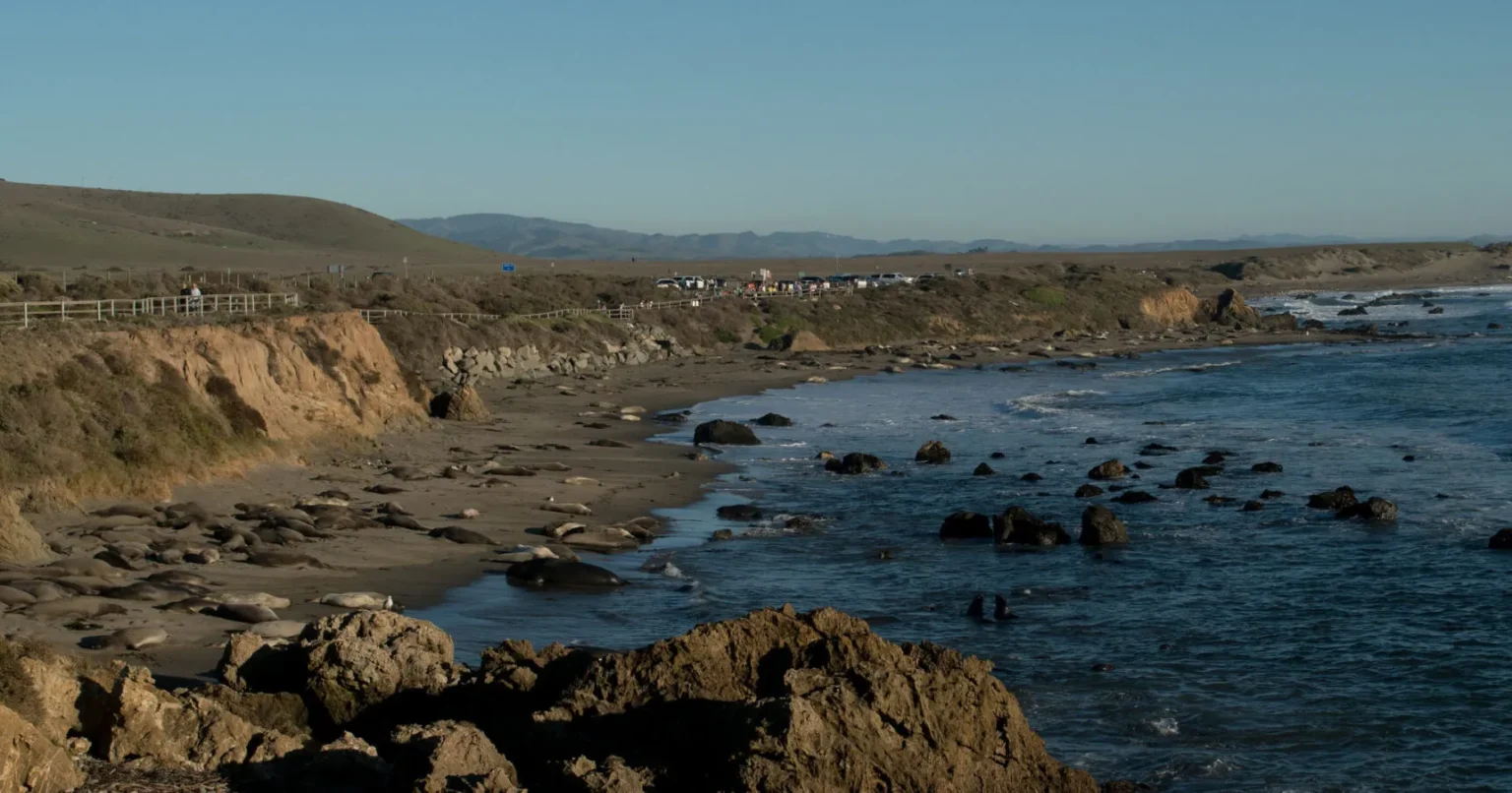
Just north of San Simeon, this vista point delivers Big Sur’s best combination: massive parking lot (200+ spaces), clean restrooms, and incredible free entertainment courtesy of 7,000 elephant seals. The elevated boardwalk keeps visitors safe while seals battle, mate, and nap just 50 feet below. December through March brings newborn pups — prepare for cuteness overload.
Friends of the Elephant Seal docents work the boardwalk daily, answering questions and sharing spotting scopes. The gift shop proceeds fund the porta-potty maintenance — worth buying a magnet to support the only reason these facilities stay clean. Morning visits mean seals are more active and parking is guaranteed. The vista point marks your transition from Big Sur wilderness back to civilization.
What Makes Elephant Seal Vista Special
Details for Elephant Seal Vista
FAQ About Big Sur Highway 1 Viewpoints
When do tour buses run on Highway 1 and how can I avoid them?
Tour buses operate heaviest 10am-3pm daily, with peak congestion on weekends April through October. They physically cannot access Pfeiffer Beach Overlook (sharp turn), Andrew Molera (fee deters them), or any unmarked pullouts. Visit major viewpoints before 9am or after 4pm. Midweek November through March sees minimal bus traffic.
Which viewpoints have actual flush toilets vs vault toilets vs nothing?
Flush toilets: Point Sur Lighthouse, Nepenthe Restaurant, Sand Dollar Beach (via campground), Ragged Point Inn. Clean vault toilets: Bixby Bridge, Andrew Molera, McWay Falls, Elephant Seal Vista. No facilities: Pfeiffer Beach Overlook, Partington Cove, Willow Creek, Jade Cove. Plan accordingly — gaps between restrooms can exceed 30 miles.
Is there really nowhere to park for free along Big Sur?
Free parking exists at: Bixby Bridge, all unmarked pullouts, Pfeiffer Beach Overlook, Willow Creek Vista, Jade Cove, Ragged Point Inn, and Elephant Seal Vista. State parks charge $10 but your pass works at multiple parks the same day. Nepenthe is free if you buy anything (even $6 coffee). Budget $30 for parking if hitting multiple state parks.
What’s the cell phone coverage situation along Highway 1?
Extremely limited. Verizon works at Nepenthe’s gift shop and Ragged Point. AT&T gets signal at Willow Creek Vista (mile 21) and Elephant Seal Vista. Zero coverage for 40+ mile stretches. Download offline maps before starting. Bring paper maps as backup. Emergency call boxes exist every few miles but assume you’re communication-dark for most of the drive.
How much time should I budget for driving Highway 1 with photo stops?
Carmel to San Simeon without stops: 2 hours. With photos at major viewpoints: 4-5 hours. Full day with hiking and lunch: 8 hours. The road’s winding nature limits speed to 25-35 mph. Add 20 minutes per viewpoint (parking, walking, photos). Summer weekends add 30+ minutes for parking battles at popular spots. Start early to avoid rushing.
Are there alternatives when Highway 1 closes for repairs or weather?
When Big Sur closes, take Highway 101 inland (adds 1 hour). Check Caltrans QuickMap for current closures — happens 3-4 times annually for slides or maintenance. Nacimiento-Fergusson Road offers a scenic detour but isn’t suitable for RVs. During closures, locals use Carmel Valley Road to access northern Big Sur. Always verify road status 24 hours before traveling.
Final Thoughts: Timing Your Big Sur Journey
After years of dodging tour buses and hunting for parking along Highway 1, the secret isn’t finding hidden viewpoints — it’s timing your visit strategically. Those 7am starts reward you with misty Bixby Bridge photos and McWay Falls solitude that Instagram influencers would kill for. The infrastructure improvements of 2024-2025 finally added enough restrooms to make the journey comfortable.
Remember: Big Sur’s beauty hasn’t diminished, but the crowds have multiplied. Armed with this guide’s bathroom locations, parking intel, and crowd-avoidance tactics, you’ll experience the coastline like locals do — efficiently navigating between tour bus chaos to find those perfect moments of coastal zen. Just don’t forget to actually look at the view instead of just photographing it.
Save this guide: Bookmark for your Big Sur trip — cell service won’t help you once you’re on Highway 1